# Drone Inspection Services for Infrastructure: How Aerial Technology Is Transforming Bridges, Pipelines, and Public Works
America's infrastructure is aging. According to the American Society of Civil Engineers, the U.S. receives a C- grade on its infrastructure report card, with hundreds of thousands of bridges, miles of pipelines, and critical public works assets requiring regular inspection and maintenance. Traditional inspection methods are slow, expensive, and often dangerous—requiring scaffolding, rope access teams, lane closures, and extended downtime.
Enter professional drone inspection services. FAA-certified drone pilots are now helping infrastructure owners, engineers, and government agencies inspect assets faster, safer, and at a fraction of the traditional cost. At CAAP Solutions LLC, we specialize in aerial inspection services that give infrastructure professionals the data they need to make smarter maintenance decisions.
## The Infrastructure Inspection Challenge
Infrastructure inspection is one of the most demanding and high-stakes fields in civil engineering. Inspectors must assess:
- **Bridges and overpasses** for structural cracks, corrosion, spalling concrete, and joint deterioration
- **Pipelines and utility corridors** for leaks, ground subsidence, encroachment, and right-of-way compliance
- **Cell towers and communication infrastructure** for antenna alignment, structural integrity, and equipment condition
- **Dams and retaining walls** for seepage, erosion, and surface degradation
- **Roads and highways** for pavement distress, drainage issues, and slope stability
- **Power transmission lines** for conductor sag, vegetation encroachment, and hardware wear
Traditional methods require inspectors to physically access these structures—often at height, over water, or in confined spaces. This creates significant safety risks, requires expensive equipment, and can take days or weeks to complete.
## How Drone Inspection Services Work
Professional drone inspection services use FAA Part 107-certified pilots operating advanced unmanned aerial systems (UAS) equipped with high-resolution cameras, thermal imaging sensors, LiDAR, and multispectral payloads. Here's how a typical infrastructure drone inspection unfolds:
### 1. Pre-Flight Planning and Coordination
Our team reviews engineering drawings, coordinates with asset owners, and files any required FAA waivers or airspace authorizations. For complex infrastructure like bridges near airports or pipelines crossing controlled airspace, proper regulatory compliance is essential.
### 2. Aerial Data Collection
Drones fly systematic, pre-programmed flight paths to capture overlapping imagery of the entire asset. For bridge inspections, this includes the deck, superstructure, substructure, and pier caps. For pipelines, we fly the full corridor capturing both nadir (straight-down) and oblique imagery.
### 3. Data Processing and Analysis
Raw imagery is processed using photogrammetry software to create orthomosaics, 3D point clouds, and digital surface models. Thermal data reveals heat anomalies indicating moisture intrusion or electrical faults. LiDAR data provides precise measurements for deformation analysis.
### 4. Deliverable Reporting
Clients receive comprehensive inspection reports with annotated imagery, GPS-tagged defect locations, condition ratings, and recommended maintenance actions—all in formats compatible with asset management systems.
## Key Benefits of Drone Infrastructure Inspections
### Dramatically Improved Safety
Drone inspections eliminate the need for inspectors to work at height, over water, or in confined spaces. This reduces the risk of falls, equipment accidents, and exposure to hazardous environments. For bridge inspections alone, drones can eliminate the need for under-bridge inspection vehicles (UBIVs) and lane closures that put both workers and motorists at risk.
### Faster Turnaround Times
A bridge inspection that might take a traditional crew 3-5 days can often be completed in a single day with drones. Pipeline corridor surveys covering dozens of miles can be completed in hours rather than weeks. This speed translates directly to reduced project costs and faster decision-making.
### Cost Savings
By eliminating scaffolding, rope access teams, lane closures, and extended mobilization, drone inspections can reduce inspection costs by 50-80% compared to traditional methods. For agencies managing large asset portfolios, these savings are transformational.
### Superior Data Quality
Modern drone sensors capture imagery at resolutions that reveal defects invisible to the naked eye from the ground. 4K video, 61-megapixel still cameras, and thermal sensors provide inspectors with unprecedented detail. GPS-tagged imagery allows precise defect mapping and year-over-year comparison.
### Minimal Disruption
Drone inspections can often be conducted without closing roads, interrupting service, or requiring public notification. This is particularly valuable for bridges on high-traffic corridors and pipelines in sensitive environmental areas.
## Real-World Infrastructure Applications
### Bridge Inspection
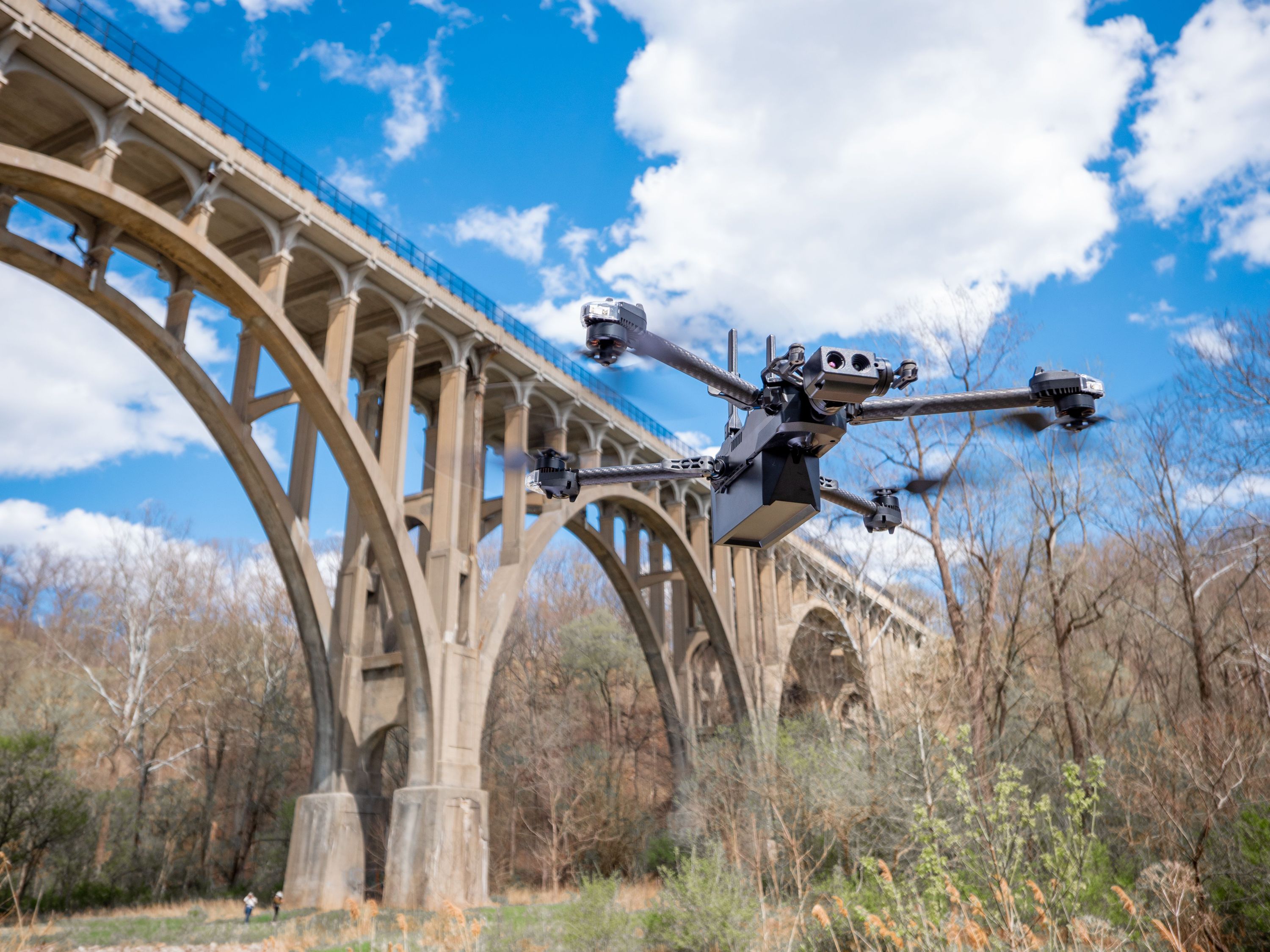
Drones are now widely accepted by state DOTs for routine bridge inspections. Our aerial systems can access the underside of bridge decks, inspect pier caps below the waterline using waterproof drones, and capture the full superstructure in a single mobilization. Deliverables include condition-rated imagery mapped to bridge element codes.
### Pipeline and Utility Corridor Monitoring
For pipeline operators, regular aerial surveillance is essential for detecting encroachment, ground movement, and right-of-way violations. Our thermal-equipped drones can detect temperature anomalies indicating potential leaks in gas pipelines, while multispectral sensors identify vegetation stress patterns that may indicate underground leaks.
### Tower and Antenna Inspection
Cell towers, transmission towers, and communication infrastructure require regular inspection but present extreme fall hazards for climbers. Drone inspections provide equivalent or superior data without putting climbers at risk, and can be completed in a fraction of the time.
### Stormwater and Drainage Infrastructure
Culverts, retention ponds, and drainage channels require regular inspection for sediment buildup, structural damage, and vegetation encroachment. Drones provide efficient corridor surveys that would be impractical on foot.
## Regulatory Compliance and Certification
Not all drone operators are created equal. Infrastructure inspections require FAA Part 107 certification, proper insurance, and often specific waivers for operations over people, at night, or in controlled airspace. At CAAP Solutions LLC, our pilots hold active Part 107 certifications and carry commercial drone liability insurance. We handle all airspace coordination and regulatory compliance so you don't have to.
## Getting Started with Drone Infrastructure Inspections
Whether you manage a portfolio of bridges for a state DOT, oversee pipeline integrity for an energy company, or maintain public works assets for a municipality, drone inspection services can deliver immediate value. The first step is a consultation to understand your asset inventory, inspection requirements, and data deliverable needs.
CAP Solutions LLC serves infrastructure clients throughout the region, providing professional aerial inspection services backed by FAA certification, commercial insurance, and a commitment to delivering actionable data. Contact us today to discuss how drone technology can transform your infrastructure inspection program.
---
*Ready to modernize your infrastructure inspection program? [Contact CAAP Solutions LLC](https://caapsolutions.com/contact) to schedule a consultation with our FAA-certified drone inspection team.*