# Drone Inspection Services for Infrastructure: Safer, Faster, and More Accurate Assessments
Infrastructure forms the backbone of modern society—bridges carry commuters, pipelines deliver energy, power lines keep homes lit, and cell towers keep us connected. Yet inspecting these critical assets has traditionally been dangerous, expensive, and time-consuming. Enter professional drone inspection services: a game-changing technology that is transforming how engineers, municipalities, and utility companies assess and maintain the infrastructure we all depend on.
## The Problem with Traditional Infrastructure Inspections
Conventional infrastructure inspections often require workers to rappel from bridges, climb transmission towers, or navigate confined spaces inside pipelines. These methods carry significant safety risks—falls and equipment failures account for a disproportionate share of workplace injuries in the inspection industry. Beyond safety, traditional inspections are slow. Closing a lane of traffic to inspect a bridge deck, or erecting scaffolding to examine a dam face, can take days and cost tens of thousands of dollars before a single data point is collected.
For aging infrastructure—and the American Society of Civil Engineers gives U.S. infrastructure a C- grade—the need for frequent, thorough inspections is greater than ever. Drone inspection services offer a compelling solution.
## How Drone Inspection Services Work for Infrastructure
FAA-certified drone pilots deploy unmanned aerial vehicles (UAVs) equipped with high-resolution cameras, thermal imaging sensors, LiDAR scanners, and ultrasonic testing payloads to capture detailed data from virtually any angle—without putting human inspectors in harm's way.
A typical infrastructure drone inspection follows a structured workflow:
1. **Pre-flight planning:** The pilot reviews site plans, identifies hazards, and programs precise flight paths to ensure complete coverage.
2. **Data capture:** The UAV flies systematic passes over or alongside the structure, capturing 4K video, high-resolution still images, and sensor data.
3. **Real-time monitoring:** Ground-based operators monitor the live feed, flagging areas of concern for closer inspection passes.
4. **Data processing:** Imagery is processed using photogrammetry software to generate 3D models, orthomosaics, and detailed inspection reports.
5. **Deliverables:** Clients receive annotated images, condition ratings, and actionable maintenance recommendations.
## Key Infrastructure Applications for Drone Inspections
### Bridge and Overpass Inspections
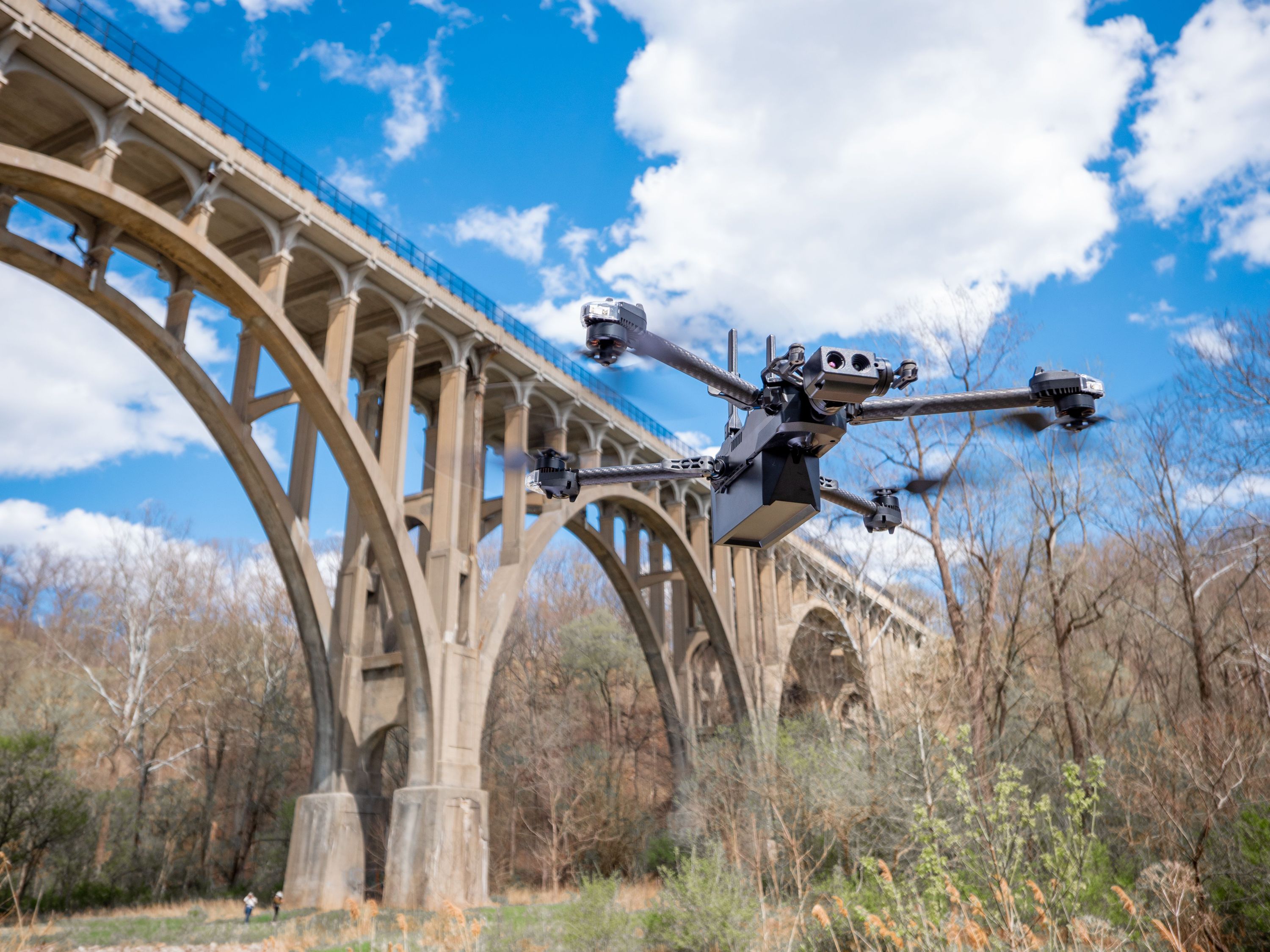
Drones can inspect every surface of a bridge—deck, girders, piers, abutments, and bearings—in a fraction of the time required by traditional under-bridge inspection vehicles (UBIs). High-resolution imagery reveals concrete spalling, rebar corrosion, cracking, and joint deterioration with millimeter-level precision. Thermal cameras detect moisture intrusion and delamination invisible to the naked eye.
### Power Line and Transmission Tower Inspections
Utility companies are rapidly adopting drone inspection services to monitor transmission lines, distribution networks, and substations. Drones can fly alongside energized lines safely, identifying damaged insulators, corroded hardware, vegetation encroachment, and conductor wear—all without de-energizing the line or deploying bucket trucks.
### Pipeline and Oil & Gas Infrastructure
Aerial drone surveys cover miles of pipeline corridor in a single flight, detecting ground movement, erosion, third-party encroachments, and surface anomalies that may indicate subsurface issues. Thermal imaging can identify temperature differentials associated with leaks or insulation failures.
### Cell Tower and Telecommunications Infrastructure
Climbing a cell tower is one of the most hazardous jobs in America. Drone inspections eliminate the need for tower climbers in routine assessment scenarios, capturing detailed imagery of antennas, mounting hardware, lighting systems, and structural members quickly and safely.
### Dams, Levees, and Water Infrastructure
Drones equipped with multispectral and thermal sensors can detect seepage, erosion, and structural anomalies across large dam faces and levee systems—assets that are notoriously difficult and dangerous to inspect manually.
## The Business Case: Cost and Time Savings
The return on investment for drone infrastructure inspections is compelling:
- **Reduced labor costs:** A drone crew of two can cover the same ground as a team of six traditional inspectors.
- **Faster turnaround:** Inspections that once took days can be completed in hours, minimizing disruption to operations and traffic.
- **Lower mobilization costs:** No scaffolding, rope access teams, or specialized vehicles required.
- **Improved data quality:** Consistent, repeatable flight paths and high-resolution sensors capture more data points than manual inspections.
- **Enhanced safety records:** Fewer workers in hazardous environments means fewer incidents and lower insurance premiums.
Studies have shown that drone inspections can reduce overall inspection costs by 30–70% compared to traditional methods, depending on the asset type and complexity.
## Regulatory Compliance and FAA Certification
Not all drone operators are created equal. Infrastructure inspections require pilots who hold an FAA Part 107 Remote Pilot Certificate and carry appropriate liability insurance. For inspections near airports, over populated areas, or at night, additional waivers and authorizations may be required.
When selecting a drone inspection provider, verify that they:
- Hold a current FAA Part 107 certification
- Carry commercial drone liability insurance
- Have documented experience with your specific asset type
- Use professional-grade UAVs with redundant safety systems
- Deliver structured, actionable inspection reports
At CAAP Solutions, our FAA-certified pilots bring years of experience inspecting critical infrastructure across the region, delivering the data quality and professionalism that asset owners and engineers demand.
## Integrating Drone Data into Asset Management
The true power of drone inspection services is realized when aerial data is integrated into broader asset management systems. Georeferenced imagery and 3D models can be imported directly into GIS platforms, BIM environments, and infrastructure management software—creating a living digital record of asset condition over time.
Repeat inspections using identical flight paths enable precise change detection, allowing engineers to track crack propagation, corrosion progression, and settlement with quantitative accuracy. This data-driven approach supports proactive maintenance planning, helping agencies prioritize repairs before minor defects become costly failures.
## Conclusion: The Future of Infrastructure Inspection Is Aerial
As infrastructure ages and inspection budgets tighten, drone inspection services represent one of the most impactful tools available to asset owners, engineers, and municipalities. By combining safety, speed, and data quality in a cost-effective package, professional UAV inspections are rapidly becoming the new standard for infrastructure assessment.
Whether you manage bridges, utilities, pipelines, or telecommunications assets, CAAP Solutions is ready to deliver the aerial intelligence you need to keep your infrastructure safe and operational. Contact us today to schedule a consultation and discover how our drone inspection services can transform your maintenance program.